
<Back>
|
| Close
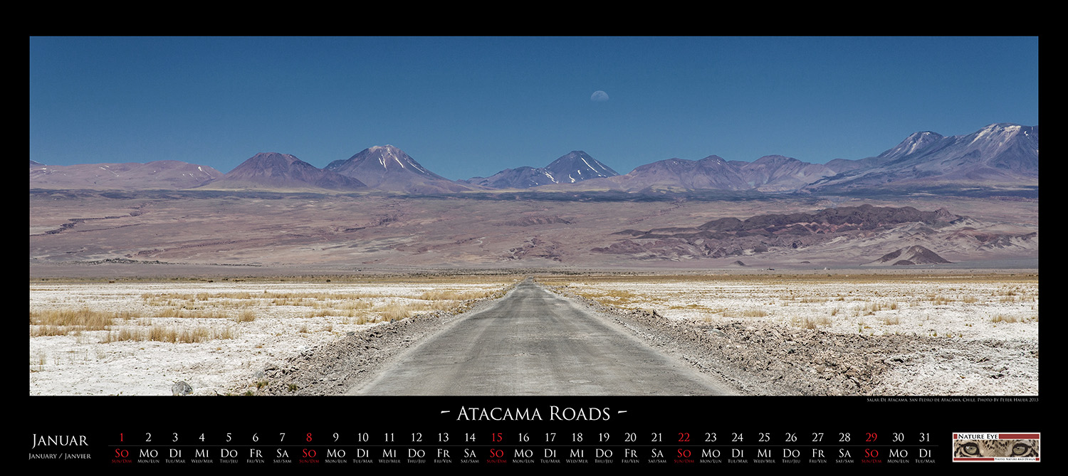
to the border with Argentina is the Salar de Atacama, with an area of
about 3000 square kilometers the largest salt lake in Chile. To the
east the lake is bordered by the Andes with their active volcanoes.
Only a few streets from firmly-baked salt cut through these sheer
endless open areas. They are used by the trucks carrying the mined raw
materials such as lithium and borax. |
|
|
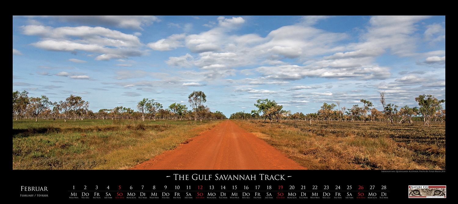
| Seemingly
endless the Savannah Way cuts through the tropical northern Australia
on its 3500 km long journey from Broome, on the Western Australian
coast, to Cairns. Countless eucalyptus forests, scrubland and slow
drying billabongs, filled with water from the rainy season, dot the
landscape along the way. The open and wide sky and the straight red
strip of road, which extends over the horizon, lets you feel the
seclusion of the Australian North. |
|
|
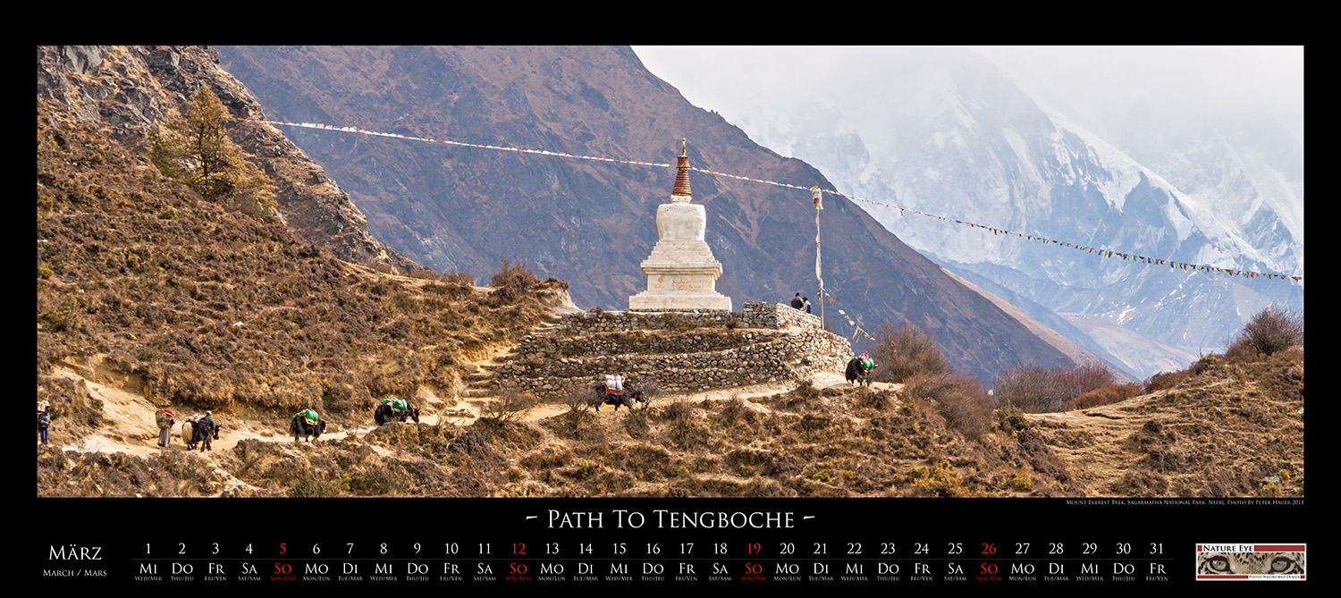
| Less
a road but rather only a path is the Mount Everest Trek, a 62km long
supply and walking trail that leads from Lukla, a market town and the
starting point of almost every Everest expeditions, up to the Everest
Base Camp at the foot of the Khumbu Glacier. It is futile to look after
any kind of wheels on this track. At this height, goods are mostly
transported by yaks or indigenous Sherpas. Many of them carrying loads
of 50kg and more up to the Base Camp, located at an altitude of
approximately 5400 m. |
|
|
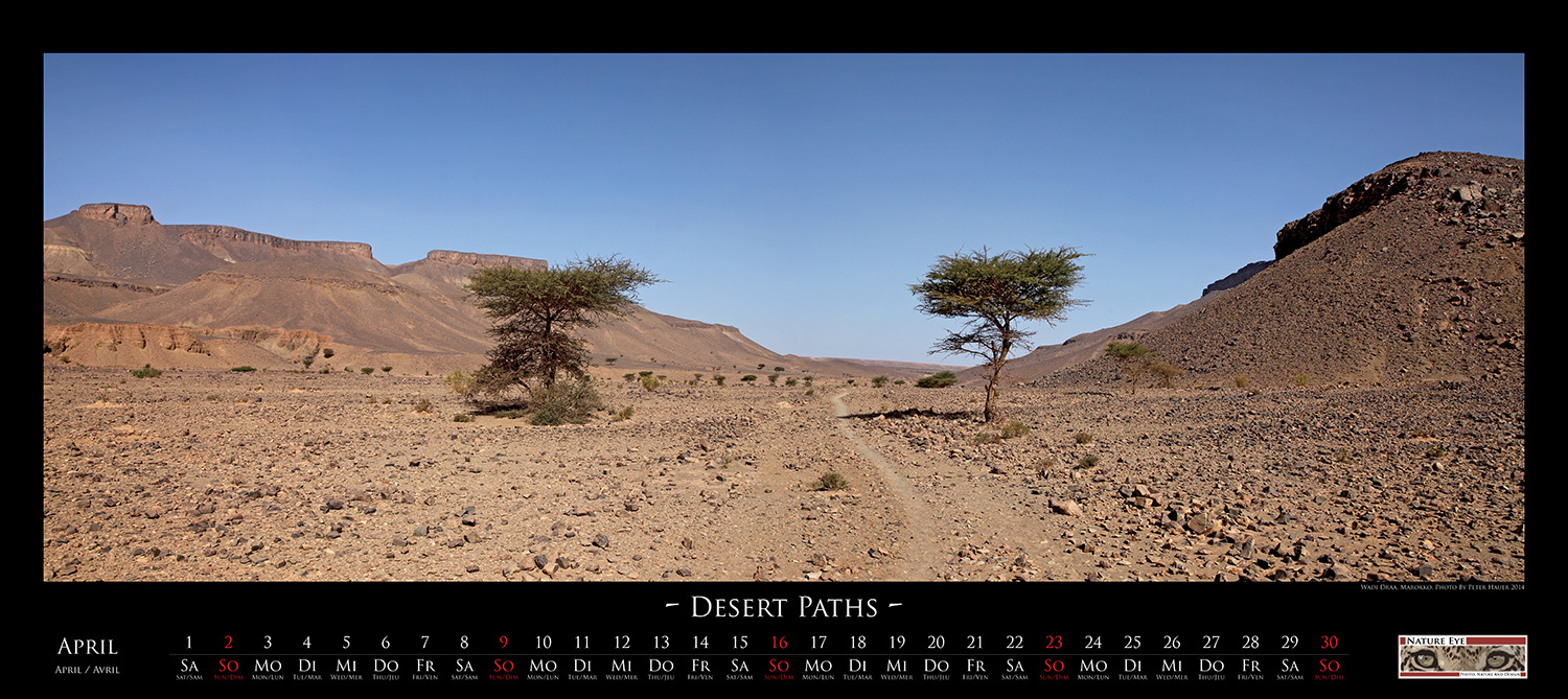
| Only
Acacia cast a slight shadow on the path that follows the Algerian
border in southern Morocco. Thousands of years ago a green branch of
the Draa River followed the valley where nowadays the path winds in a
barren stony desert. Yet, there is life here. At night when it
gets cooler, the North African desert fox, called Fennec fox, hunts for
insects, lizards and small mammals. |
|
|
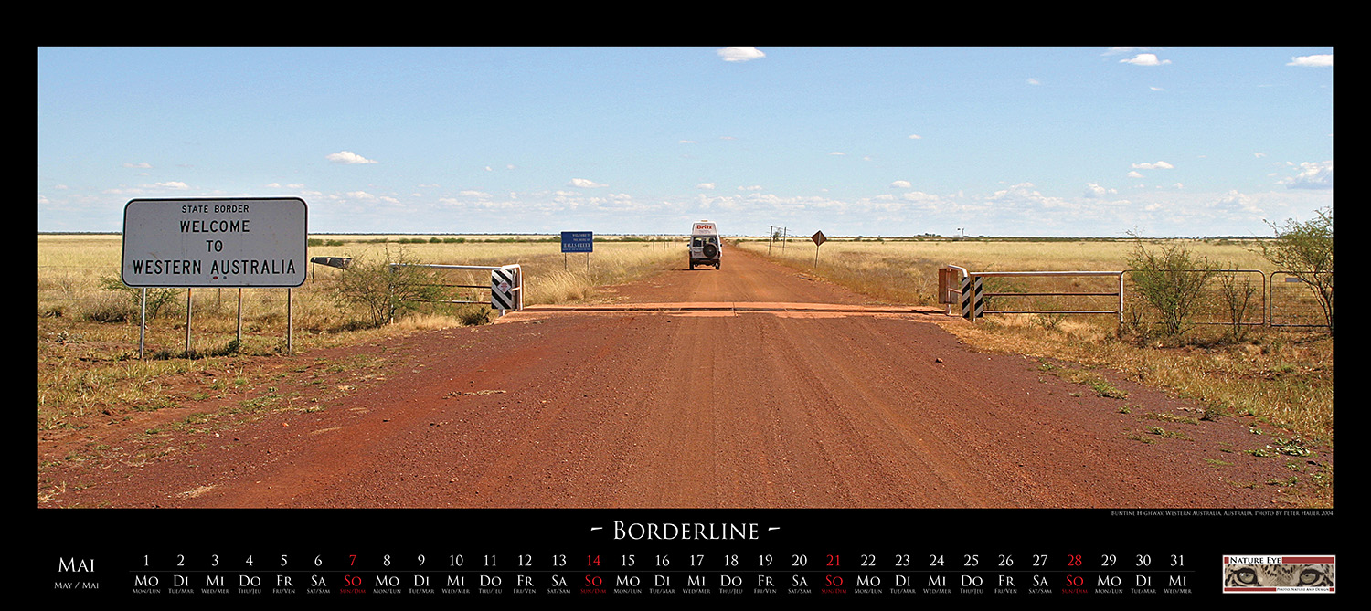
| Somewhere
in nowhere crosses the Highway 96, also known as Buntine Highway, the
border between the Australian states of Northern Territory and Western
Australia. There are still about 150 km towards the west from here to
Halls Creek, a small town with about 1500 residents. If you follow the
highway in the opposite direction, there are about 250 km to Top
Springs, a remote roadhouse with a supermarket, pub and simple
accommodations for tourists and the drivers of the road trains. |
|
|
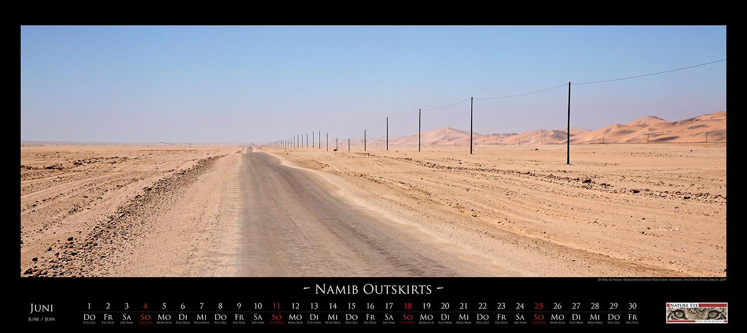
| Between
Swakopmund and Walfisbay runs bolt upright, the D1984 , a side road
that follows the foothills of the Namib Desert. Directly behind the
dunes lies the South Atlantic which is with its steady cold flow not
only responsible for the dry but also for the in these latitudes very
cool climate. Not infrequently the endless view disappears in an
impenetrable fog, which dissolves only by the midday sun. |
|
|
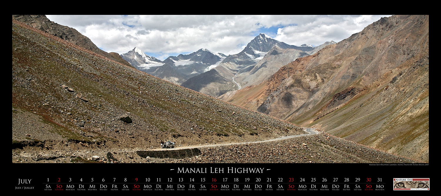
| The
Manali Leh Highway in northern India connects the Ladakh region in
Kashmir with the city of Manali in the Himachal Pradesh district. On
its 477 km long journey it climbs over several of the highest motorable
passes of this earth. Its highest point is the Taglang La Pass with an
altitude of 5325 meters. Its passage is possible only from June to
mid-September. However, even at this time it may happen that the road
becomes impassable after heavy rains and landslides for days. |
|
|
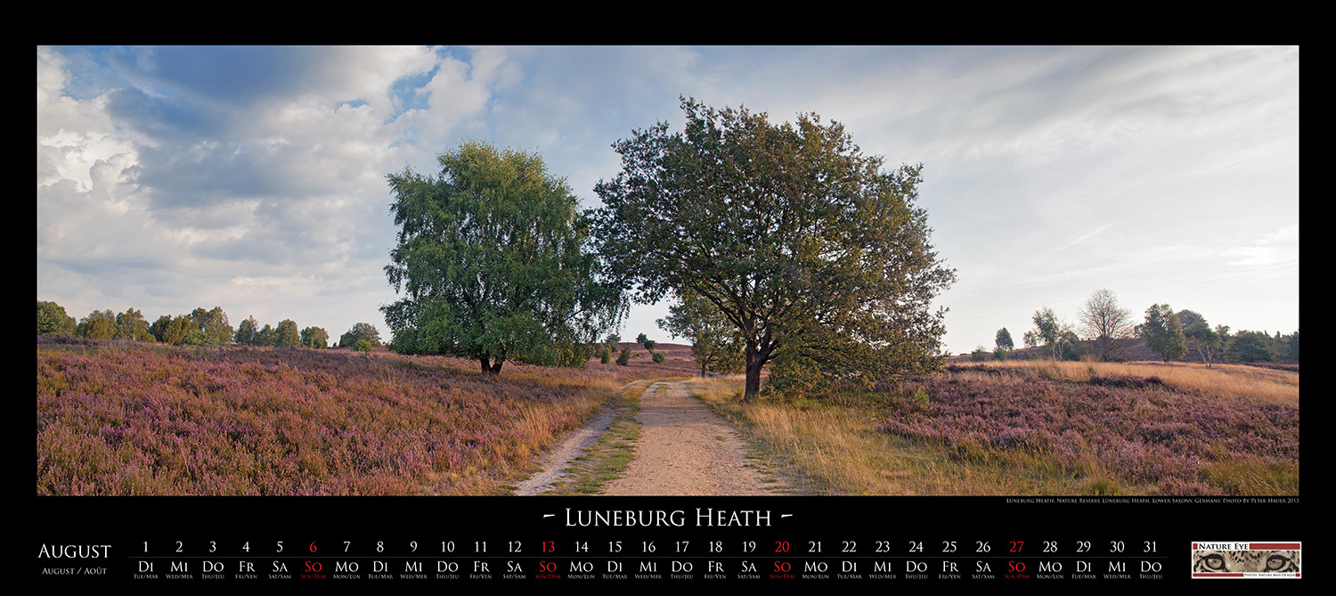
| Shortly
before sunrise, a cold air lies above the Lüneburg Heath Nature Reserve
and lets the morning dew fall on the heather. Now, at the end of the
August, the heather is in full bloom. Tranquil paths lead through the
purple-colored parts of the 234 square kilometer area which is part of
one of the largest continuous heathland in Europe and invite for hiking. |
|
|
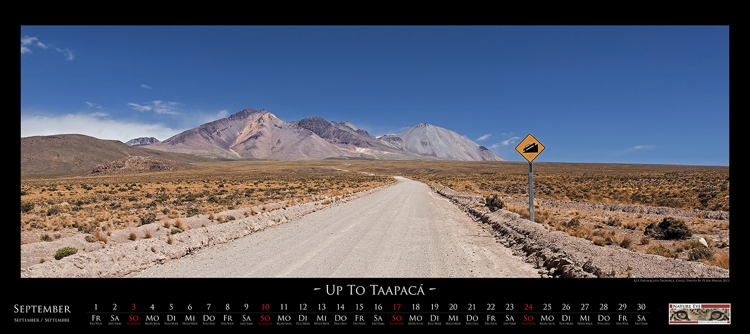
| In
the far north of Chile, about five kilometers east of Putre, the A23
begins, a dusty unsealed road that leads through a spectacular region
of Altiplano. The road initially winds around the slopes of the volcano
Taapacá up to the highest point at 5242 meters before it starts to
follow a slightly declining plateau. About 15 kilometers further, the
road crosses in a deep valley the Rio Lluta. |
|
|
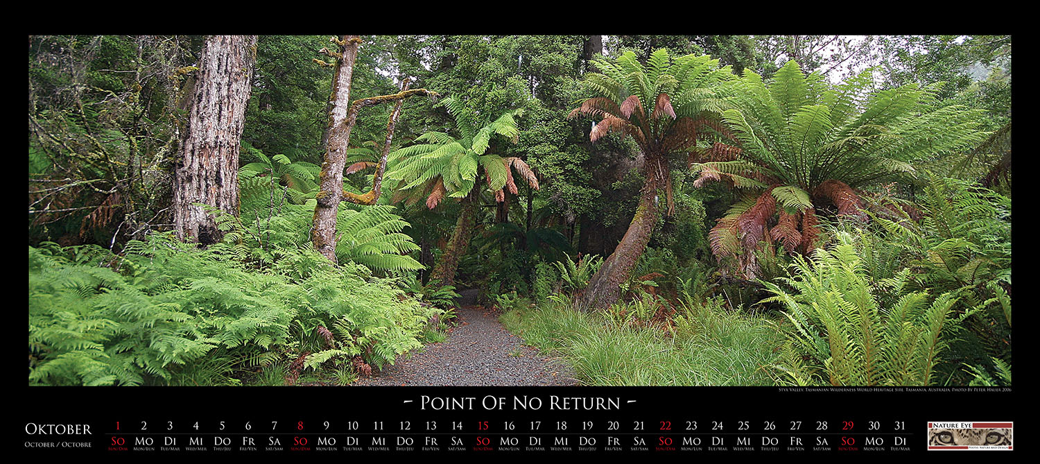
| In
the northwest of Tasmania spreads the Tasmanian Wilderness World
Heritage Area, a nature reserve protected by the UNESCO. The protected
area covers about one fifth of the total territory of the Tasmanian
island. A large part of this terrain is covered by an impenetrable
temperate rainforest. Few paths lead into this area and even fewer lead
out. |
|
|
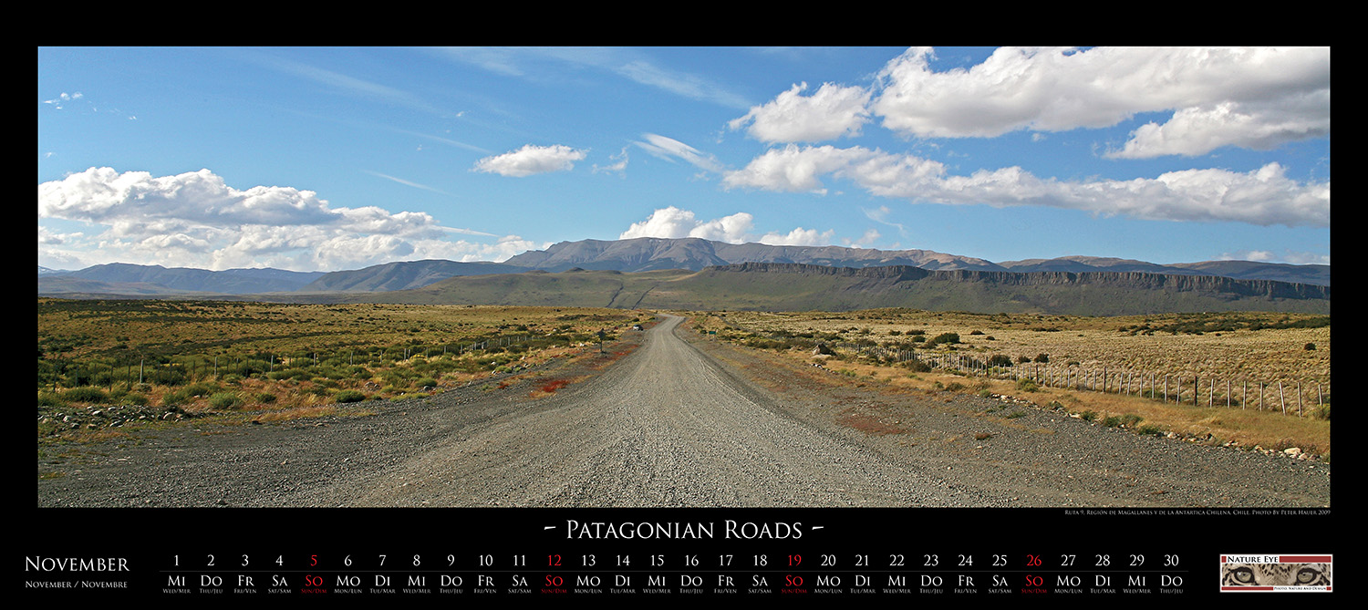
| In
the south of Chile a dusty gravel road, named Route 9, leads from the
port of Punta Arenas to the north towards the border of the
Parque Nacional Torres del Paine. Here in the Magallanes y la Antártica
Chilena region you can feel the proximity of the Antarctic Sea. Cold
gale winds with rain and snow alternate with short periods of blue sky
and sunshine. Only grasses and bushes can survive in this inhabitable
part of Chilean Patagonia. |
|
|
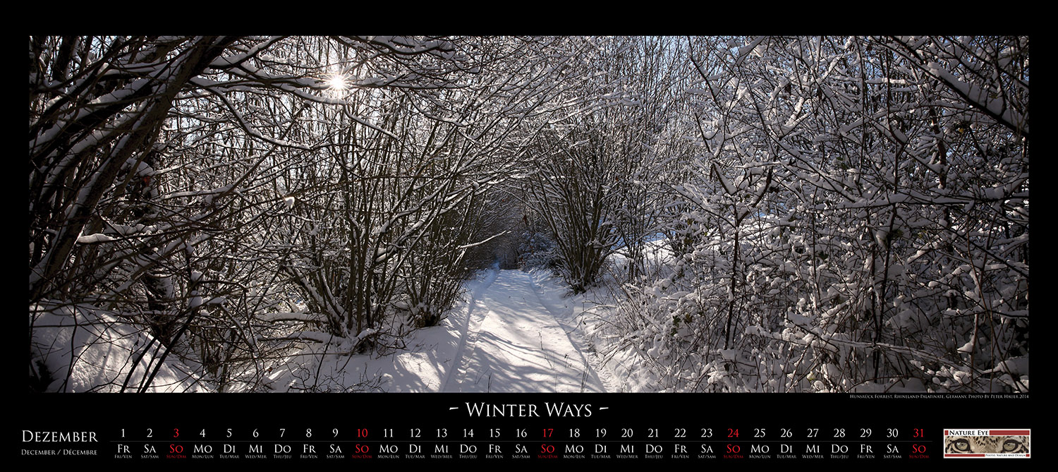
| During
the night a polar cold front has moved over central Europe and has hit
the Hunsrück, a low mountain range in the western of Germany. With
heavy snowfall it has covered the scenery under a white blanket.
However, at dawn, the bad weather has moved on and the rising sun in
the clear sky brings the forests of the Hunsrück into the light of a
brilliant winter landscape. |
|
<Back> |