

<Back>
|
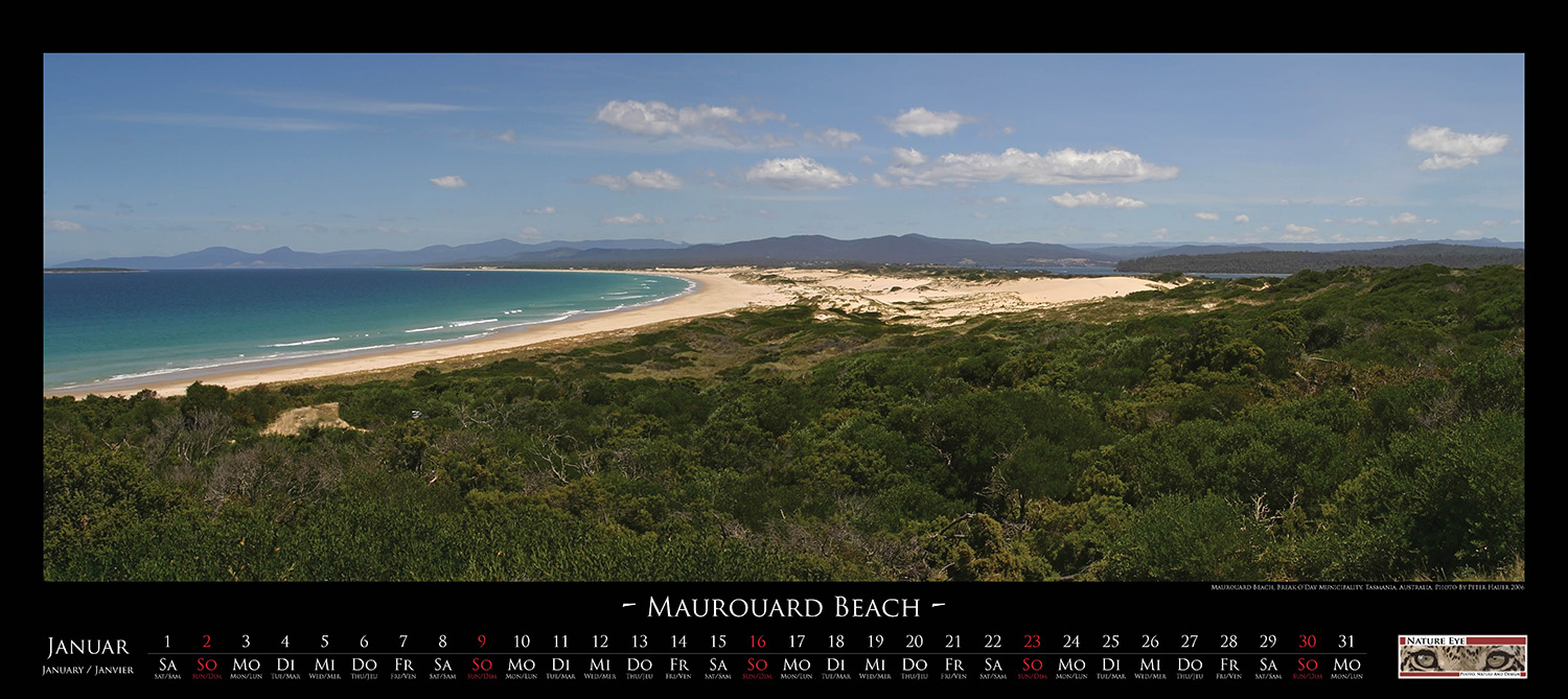
| In
the northeast of Tasmania extends the Maurouard Beach above a length of
nine kilometers. It is part of the St. Helens conservation reserve
which is the home of many sea birds like Oyster Catcher, Pacific Gull,
Petrel and Fairy Penguin. The Peron Dunes, which adjoin to the beach,
are the breeding ground for many of these bird species. |
|
|
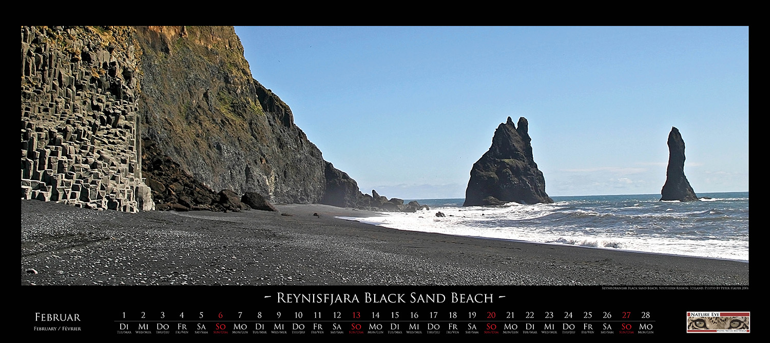
| The
beach of Reynisfjara is the most famous black sand beach in Iceland and
also one of the most famous ones in the world. It is a spot of wild and
dramatic beauty, where the roaring of the breaking waves of the
Atlantic Ocean hit the coast with their full unleashed force. At each
season and at every daylight it is a place of magnificent beauty, which
does remind humans that the forces of nature that formed Iceland are
never far away. |
|
|
| In
the south of the Ivory Coast, on the Gulf of Guinea, lies the small
settlement of Assinie-Mafia. In front of the village, separated by a
lagoon, lies a 15 kilometer long and up to 1000m wide peninsula, which
has one of the most beautiful sand beaches of the Ivory Coast. Since
the 16th century, many nations have tried to establish on this beach
trading outposts or missions. However, due to climate, diseases and
cause of the resistance of local tribes, none of the them did stay very
long. Today the beach is a popular spot for tourists and rich
Ivorians. |
|
|
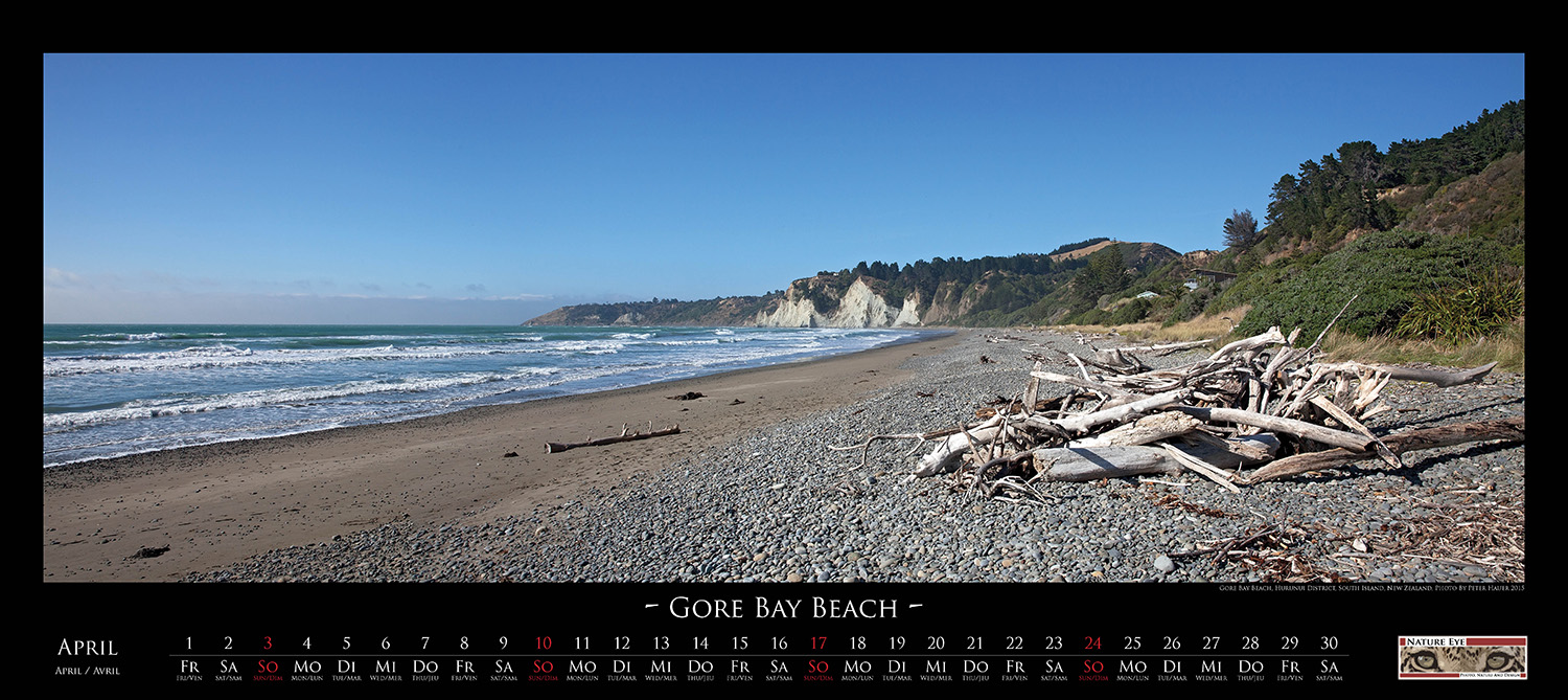
| The
last storm of spring has washed driftwood on the Gore Bay Beach, a
small beach in the northeast of the southern Island of New Zealand.
Dependent on the strength and the direction of the wind the waves,
which are now low and calm, can become several meters high, ending in a
roaring breaking of the waves. This makes the beach to a popular
spot for surfers and kiters. |
|
|
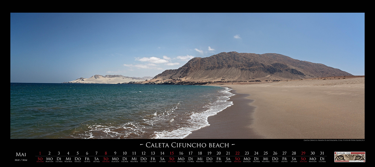
| About
25km south of the Chilean port of Taltal lies the beach of Caleta
Cifuncho. The small fishing village, which joins the bay in the south,
gave the strand its name. It is one of those places in Chile, where the
extends of the Atacama Desert meets the Pacific Ocean. The cold waters
of the Humboldt Stream, which flows directly in front of the shore,
forms a relatively cold and dry climate. Only extremely specialized
vegetation, like cactaceous and lichen can flourish in this harsh
environment. |
|
|
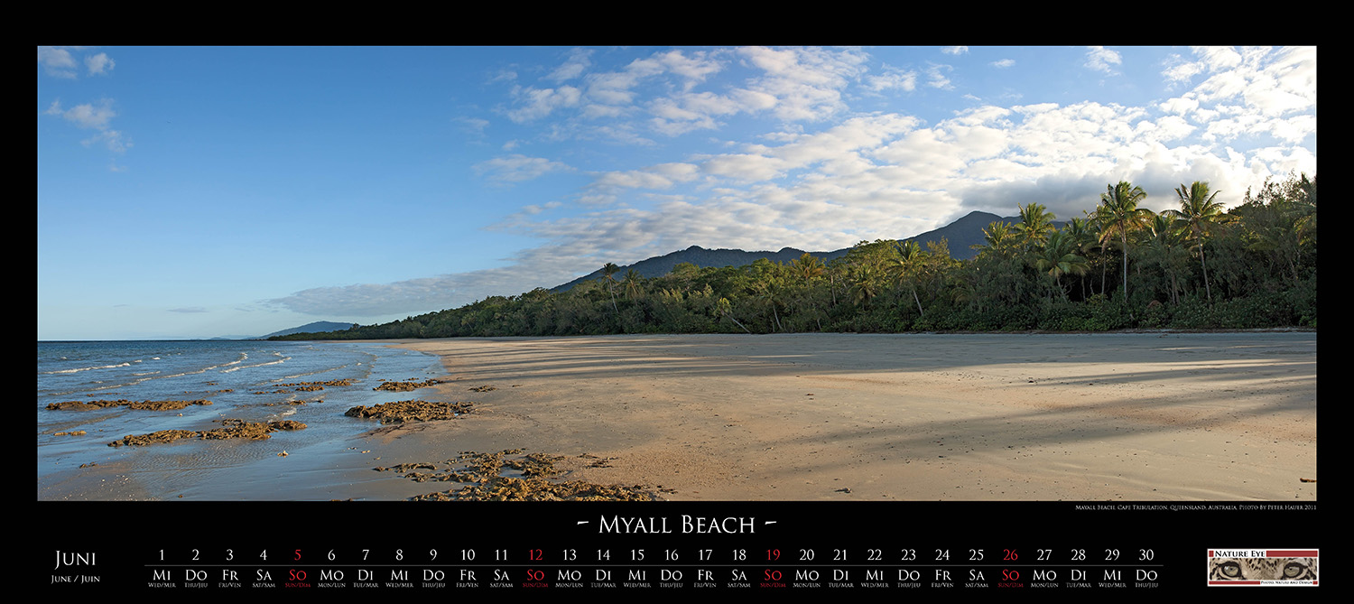
| On
the southern side of the tongue of Cape Tribulation lies Mayall beach
where two World Heritage Sites meet each other. One is the Great
Barrier Reef, which closely follows from here the coastline northwards
up to the top of the Cape York Peninsula. The other World Heritage Site
is the wet tropics vegetation of the Daintree Rainforest, which is
estimated with its age of 135 million years to be one of the oldest
rainforests in the world. It is the place where the reef kisses the
rainforest. |
|
|
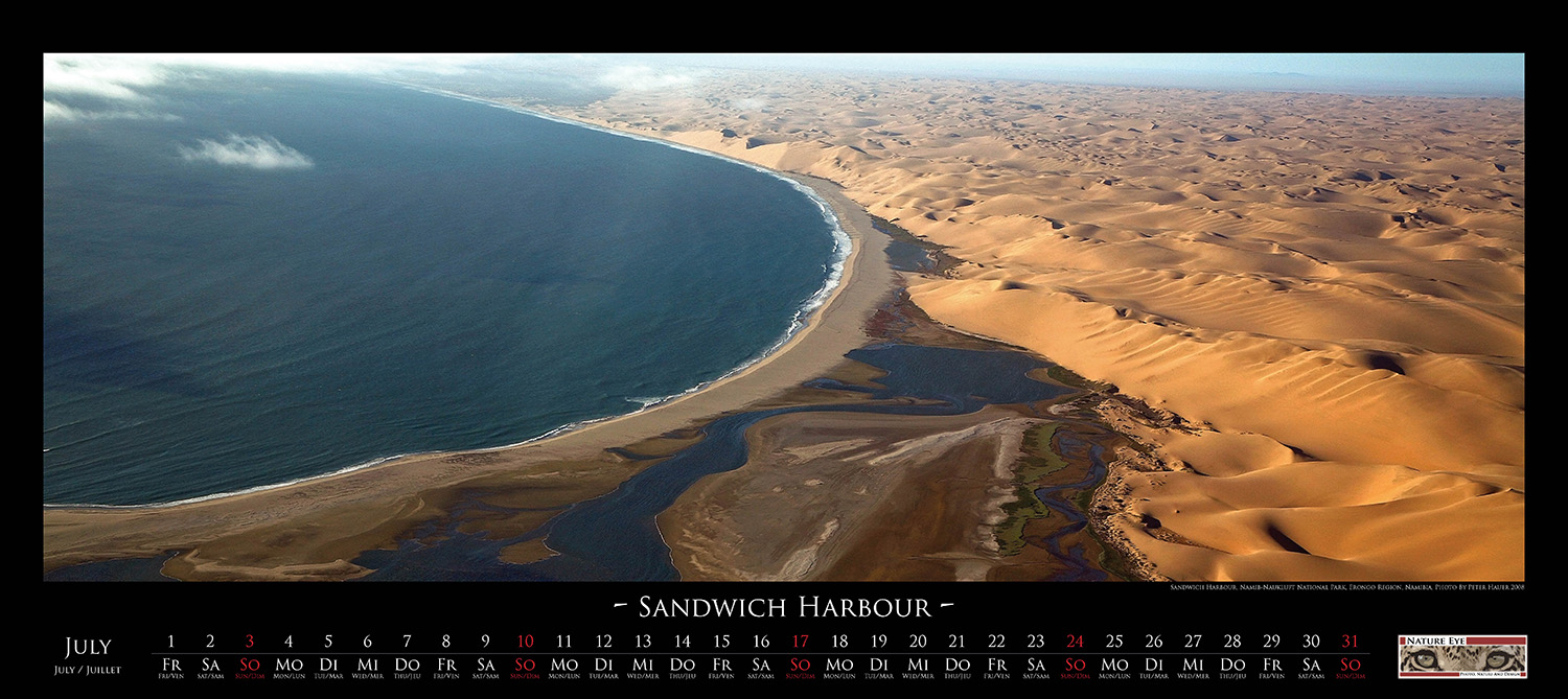
| Sandwich
Harbour is the name of a fresh water lagoon along the Namibian Atlantic
Coast which is about 40km south of Walvis Bay. Its wetlands, which are
protected by the extends of the Namib Dunes, are supplied by springs of
brackish water at the foot of those dunes. The reed grown areas around
the lagoon is inhabited by large colonies of seabirds like Flamingos,
Sea Swallows, Pelicans and Cormorants. Since 1979 the lagoon is part of
the Namib-Naukluft National Park. |
|
|
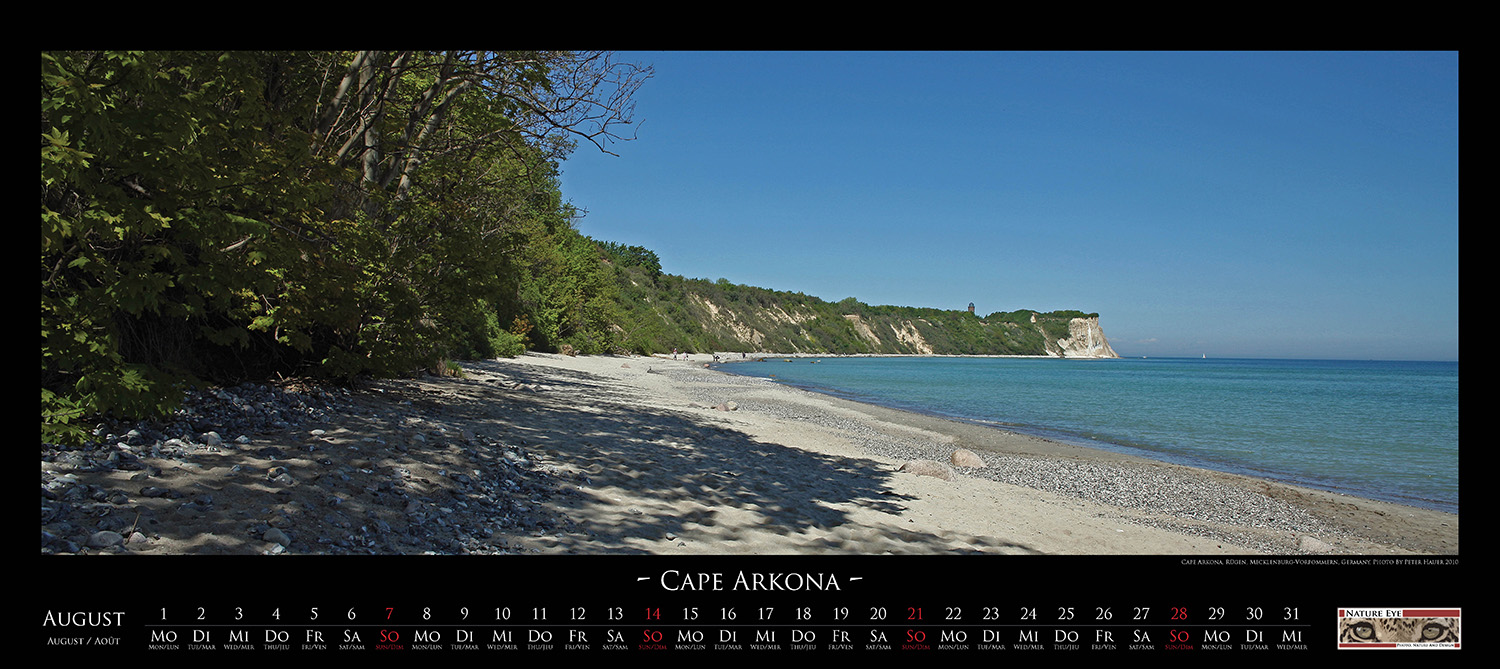
| The
Cape Arkona, a 40m high cliff coast consisting of chalkstone and marl,
is located in the north of the Baltic Sea island Rügen. Rain, wind and
waves permanently erode the cliff and have formed at its foot a narrow
beach with the length of a couple of hundred meters which ends on one
side at the small village of Vitt. A staircase with 230 steps leads
from the beach up to the top of the cliff. However, in 2012, due to the
ongoing erosion and rockfalls after storms, the stair was closed.
Slowly it will deteriorate with the vanishing of the cliff. |
|
|
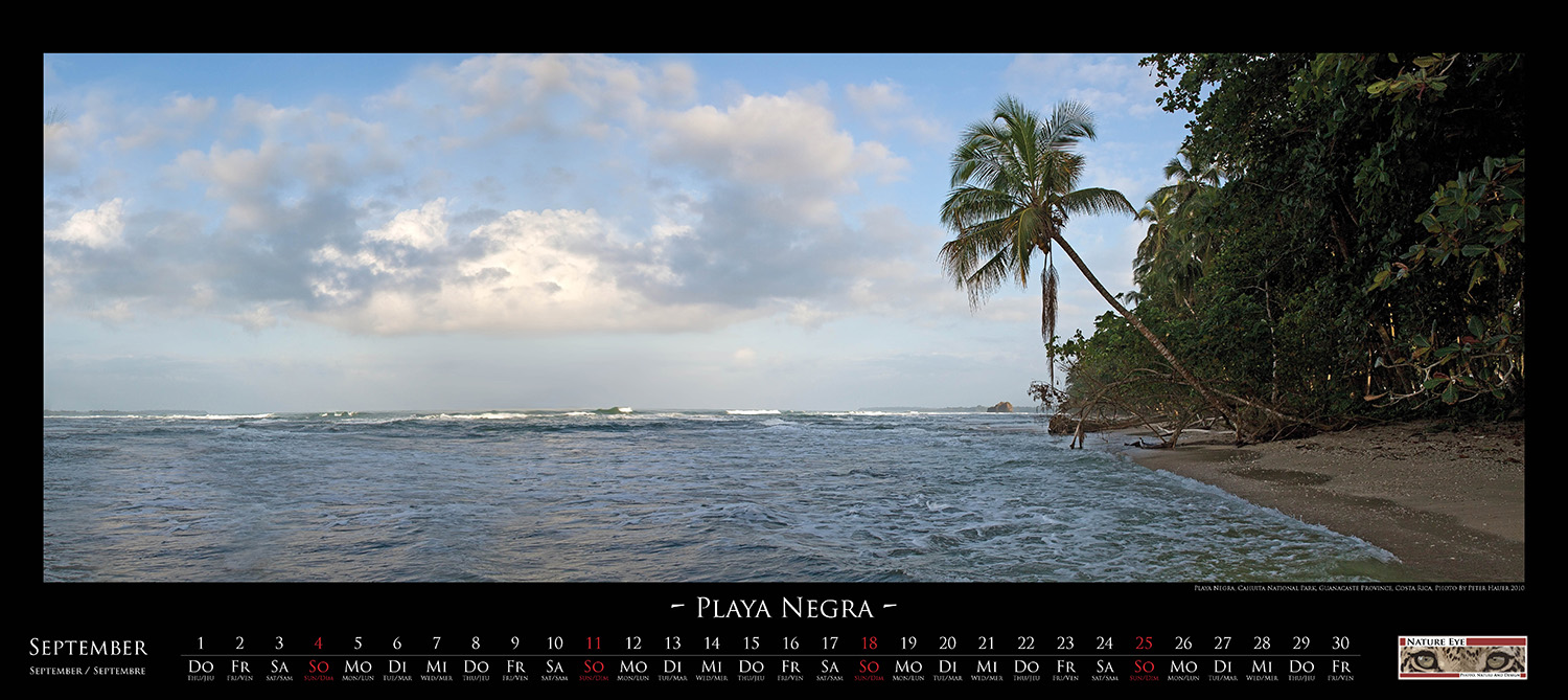
| Playa
Negra is a beach on the Pacific Coast of Costa Rica. Its name is
founded by the dark and fine sand, which has its origin in volcanic
activity. Costa Rica lies in a very active geological area with many
volcanoes and frequent earth quakes. In 2012 an earth quake did lift
the sea floor in front of the coast for about two meters. The coral
reef which lies only a few meters before the beach was moved partly
above the sea level. Today, only a few dark blocks of dead coral rocks
are still remaining from this drastic geological event. |
|
|
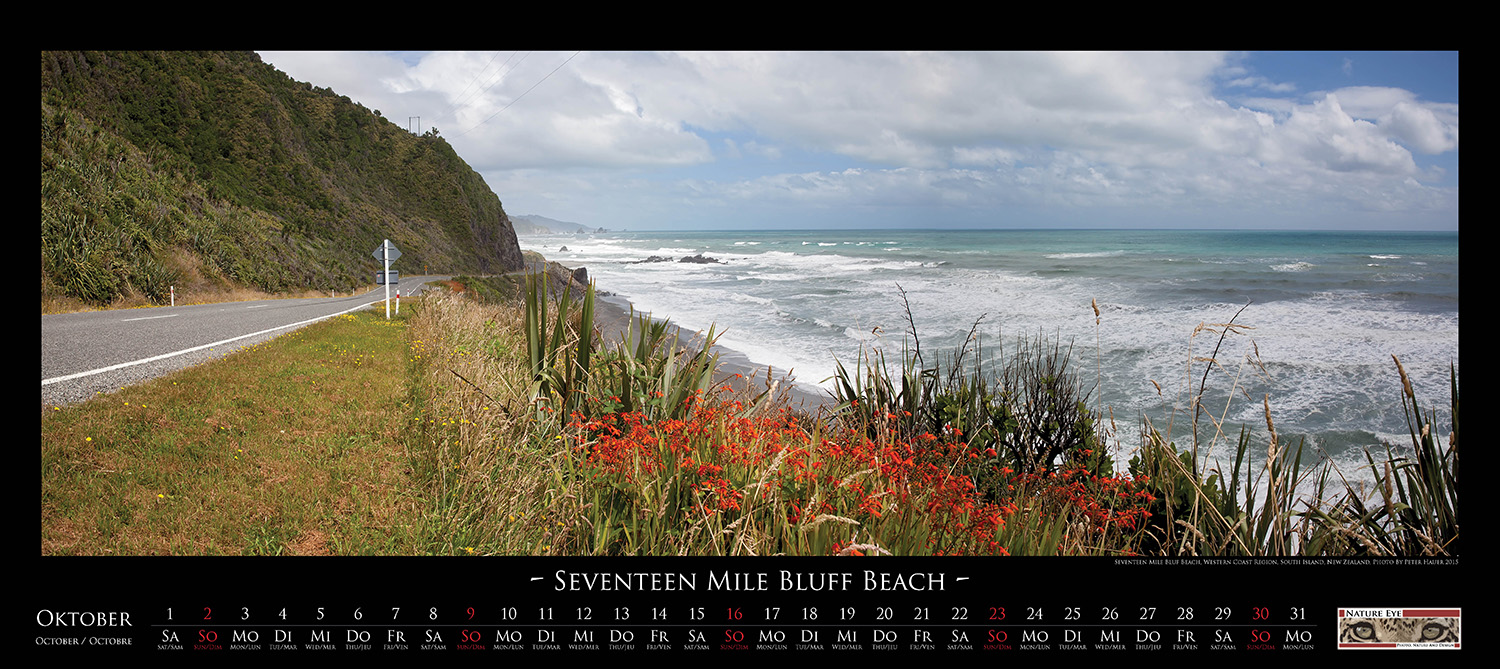
| About
six kilometers north of Greymouth lies the Seventeen Mile Bluff Beach,
a small beach along the Tasmanian Sea on the South Island of New
Zealand. The origin of the name for the beach is the cliff with the
same name and which is crossed today by the State Highway 6 which
follows the western coast of New Zealand. Most likely, early British
sailors gave the bluff its name when mapping the coast line. On the way
to Greymouth other bluffs can be past: The Fourteen-, Twelve- and the
Nine Mile Bluff. |
|
|
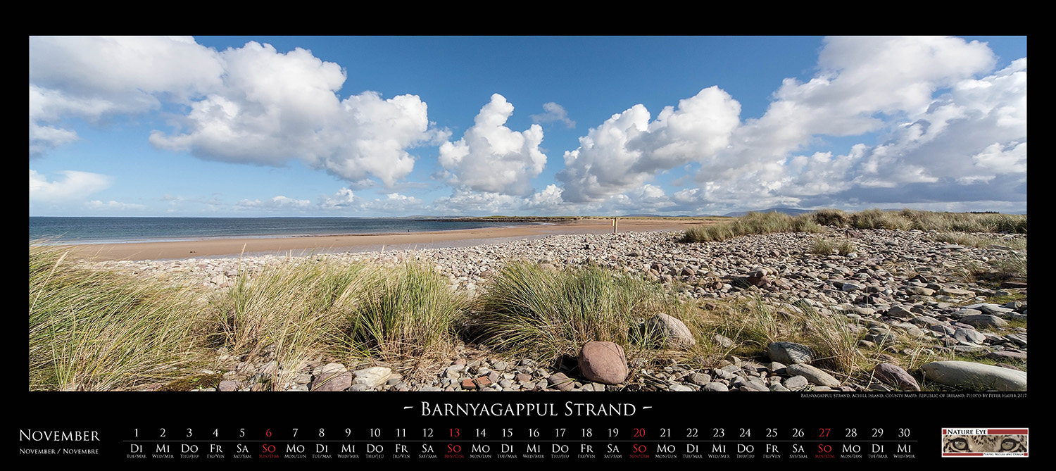
| Barnyagappul
Strand is located on Achill Island, an island with a size of about 150
km² in the northwest of Ireland. In the nineteenth century large
amounts of seaweed was cultivated and harvested at this beach. In the
beginning, the seaweed was mainly used as fertilizer, later also as a
base for the production of iodine, glass, food supplements and cosmetic
products. But with increasing industrialization, fertilizers and other
substances could be produced more cheaply and easily, so that the
cultivation of seaweed became unprofitable. However, today small
quantities are cultivated again for natural food and cosmetic products.
|
|
|
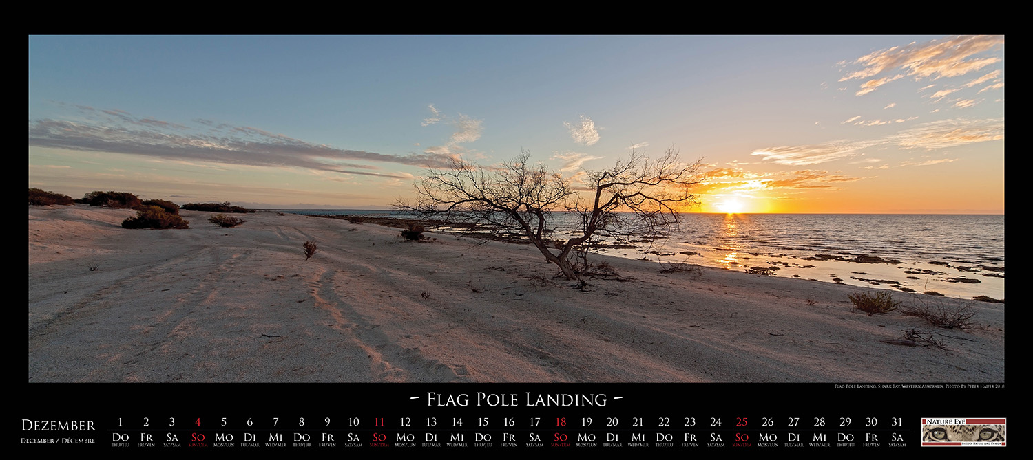
| Not
far from this beach, in 1884, the Flint Cliff Telegraph station was set
up, a relay station which was meant to establish a telegraph link
between Perth and the city of Roebourne, a mayor center during the
Australian gold rush. The far-reaching shallow waters at this coast
were perfectly suitable for the delivery of supply goods for the
telegraph station as well as for the loading of the wool of the local
farmers. A flag pole indicated the ships the exact disembarkation point
where to exchange the goods. However, today the name is the only thing
that has remained from this historic site. |
|
<Back> |